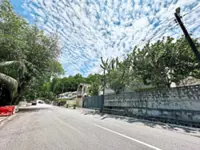
Wong (right) says updating underground utility maps in Selangor must be done to prevent accidents. — LOW BOON TAT/The Star
UPDATING underground utility maps in Selangor must be done to prevent accidents and ensure the safety of construction and repair works.
Seri Kembangan assemblyman Wong Siew Ki said the maps that were drawn decades ago might contain inaccuracies due to the technological limitations.
“Accurate mapping is important to ensure these utilities do not obstruct construction or repair work on the roads,” she said at the launch of the Walkable City Serdang 2024 − 10k Step Challenge in Kampung Baru Seri Kembangan.
Wong said she would continue monitoring her constituency for any possibilities of sinkholes, following the incident in Kuala Lumpur where on Aug 23, an Indian national identified as G. Vijayalaksmi, 48, went missing after falling into an eight-metre-deep sinkhole in Masjid India.
“Seri Kembangan is currently safe from sinkholes. We will call on the authorities to investigate if there are holes that still persist after being resurfaced.
“Damaged underground pipes with overflowing water are often found underneath sinkholes. However, the exact cause could be more complicated,” said Wong.
Following the sinkhole incident, StarMetro reported on Aug 29 that Subang Jaya City Council (MBSJ) announced plans to create a list of high-risk sinkhole areas.
Selangor Mentri Besar Datuk Seri Amirudin Shari had also said the Selangor Utility Corridor (Kusel) had been coordinating and organising the underground utility mapping system since 2020 to identify what utilities were present beneath the roads.
On a separate matter, MBSJ councillor Tey Boon Kiat said there was still room to enhance the safety of pedestrians in Serdang.
“We need more feedback from the community. For now, we will work towards having more pedestrian walkways to enhance convenience and accessibility.
“We also encourage residents to use alternative transportation such as motorcycles and bicycles, or walking instead of driving to reduce traffic congestion,” he added.


